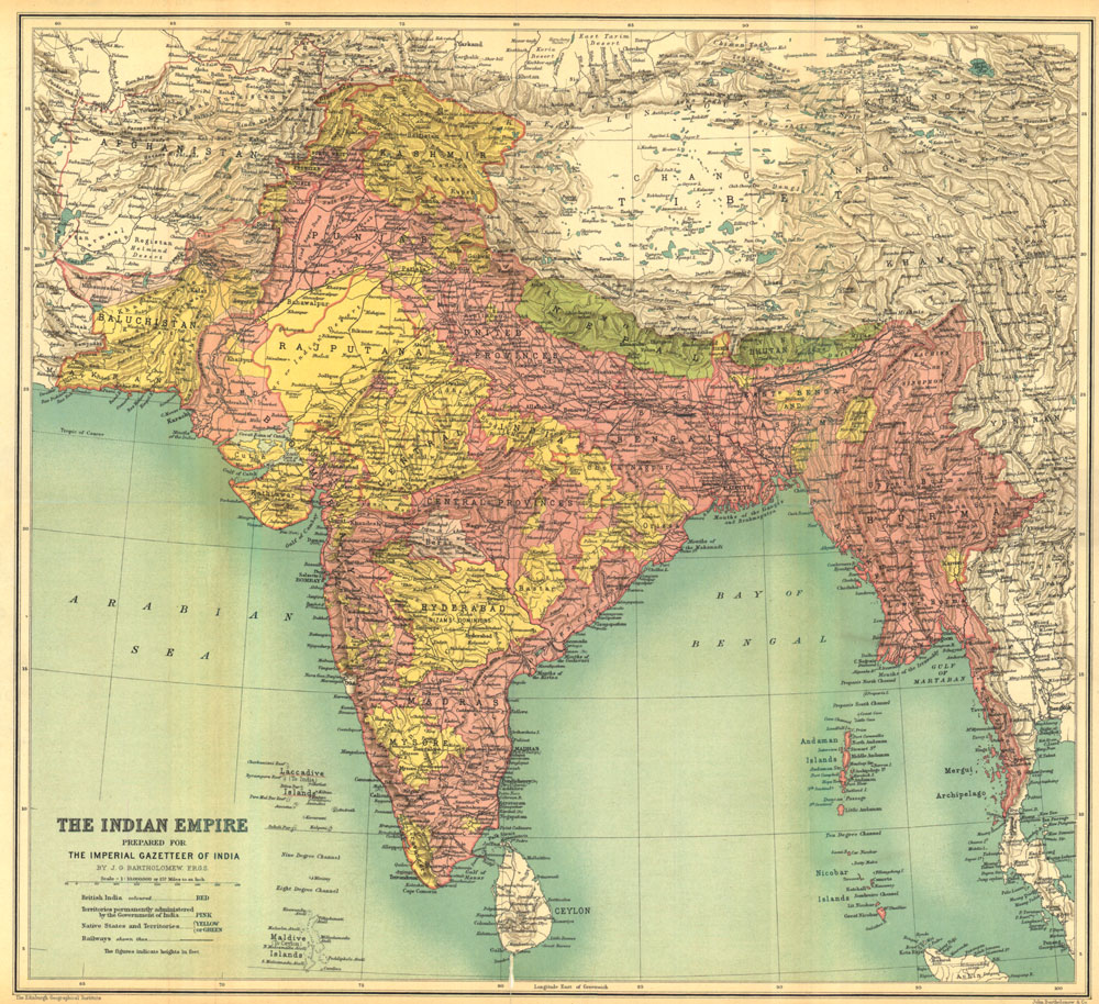
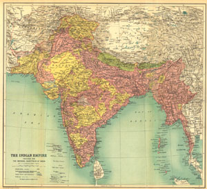
| Creator: |
J.G. Bartholomew |
| Title: |
The Indian Empire |
| Imprint: |
Imperial gazetteer of India. New edition, published under the authority of His Majesty's Secretary of State for India in Council. Oxford: Clarendon Press, 1907-1909.
All volumes, inside front cover. |
| Scale: |
1:10,000,000. 1 in. to 157 miles. |
| Notes: |
British India, colored red. Territories permanently
administered by the Government of India, colored pink. Native States
and Territories colored yellow or green. |
|
A larger version is available by clicking on the map above.
|
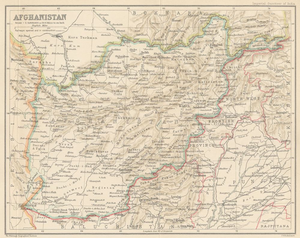
| Creator: |
J.G. Bartholomew |
| Title: |
Afghanistan |
| Imprint: |
Imperial gazetteer of India. New edition, published
under the authority of His Majesty's Secretary of State for India
in Council. Oxford: Clarendon Press, 1907-1909.
Volume 5,
opposite page 64. |
| Scale: |
1:6,000,000. 1 in. to 94.6 miles. |
|

A larger version is available by clicking on the map above.
|
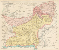
| Creator: |
J.G. Bartholomew |
| Title: |
Baluchistan |
| Imprint: |
Imperial gazetteer of India. New edition, published under the authority of His Majesty's Secretary of State for India in Council. Oxford: Clarendon Press, 1907-1909.
Volume 6,
opposite page 336. |
| Scale: |
1:6,000,000. 1 in. to 94.6 miles. |
| Notes: |
Native States colored yellow. |
|
A larger version is available by clicking on the map above.
|
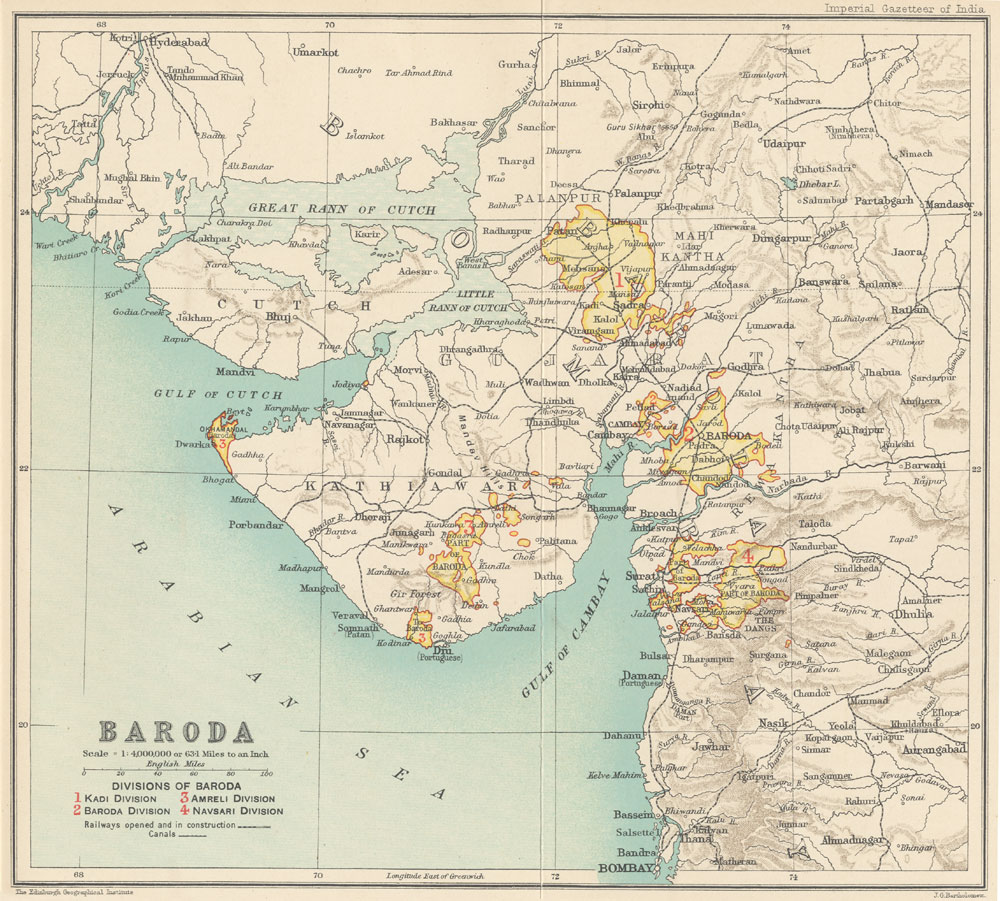
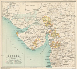
| Creator: |
J.G. Bartholomew |
| Title: |
Baroda |
| Imprint: |
Imperial gazetteer of India. New edition, published under the authority of His Majesty's Secretary of State for India in Council. Oxford: Clarendon Press, 1907-1909.
Volume 7,
opposite page 64. |
| Scale: |
1:6,000,000. 1 in. to 94.6 miles. |
| Notes: |
Divisions of Baroda: 1. Kadi Division, 2. Baroda
Division, 3. Amreli Division, 4. Navsari Division. |
|
A larger version is available by clicking on the map above.
|
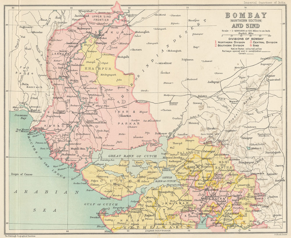
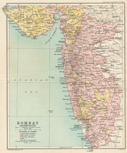
| Creator: |
J.G. Bartholomew |
| Title: |
Bombay (Northern section) and Sind |
| Imprint: |
Imperial gazetteer of India. New edition, published under the authority of His Majesty's Secretary of State for India in Council. Oxford: Clarendon Press, 1907-1909.
Volume 8, opposite page
384. |
| Scale: |
1:4,000,000. 1 in. to 63.1 miles. |
| Notes: |
Divisions of Bombay: 1. Northern Division, 2. Southern
Division, 3. Central Division, 4. Sind. |
|

A larger version is available by clicking on the map above.
|
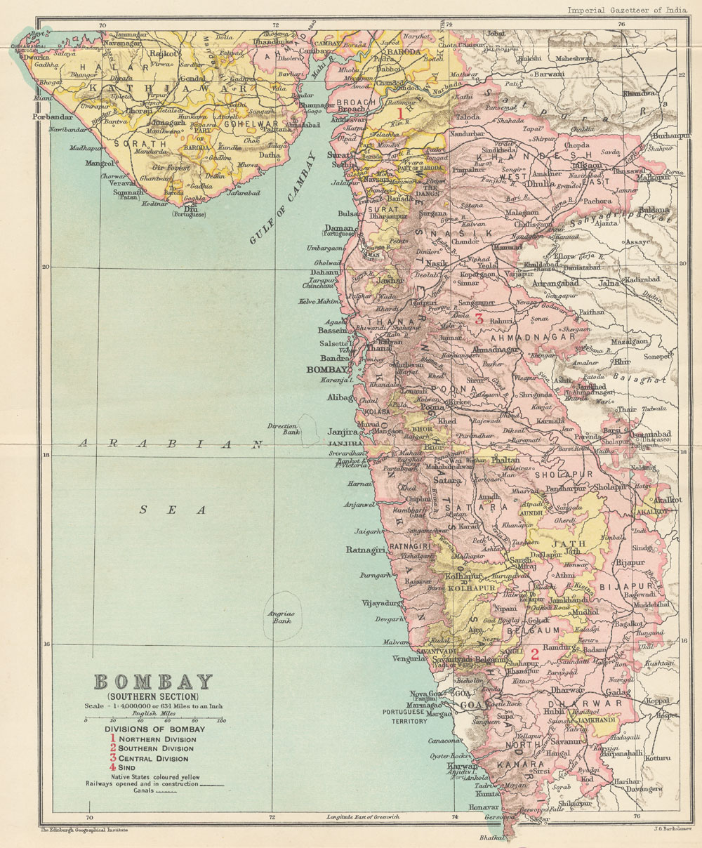
| Creator: |
J.G. Bartholomew |
| Title: |
Bombay (Southern section) |
| Imprint: |
Imperial gazetteer of India. New edition, published under the authority of His Majesty's Secretary of State for India in Council. Oxford: Clarendon Press, 1907-1909.
Volume 8, opposite page
384. |
| Scale: |
1:6,000,000. 1 in. to 94.6 miles. |
| Notes: |
Divisions of Bombay: 1. Northern Division, 2. Southern
Division, 3. Central Division, 4. Sind. |
|
A larger version is available by clicking on the map above.
|
| Creator: |
J.G. Bartholomew |
| Title: |
City of Bombay |
| Imprint: |
Imperial gazetteer of India. New edition, published
under the authority of His Majesty's Secretary of State for India
in Council. Oxford: Clarendon Press, 1907-1909.
Volume 8, inside back cover. |
| Scale: |
1 in. to .4 miles. |
|
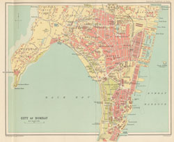
A larger version is available by clicking on the map above.
|
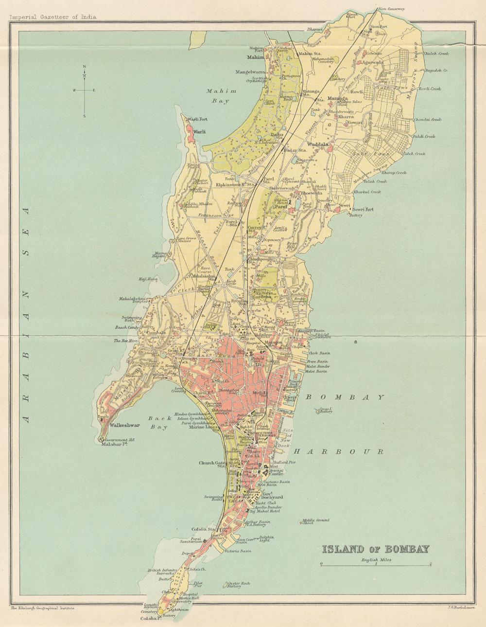
| Creator: |
J.G. Bartholomew |
| Title: |
Island of Bombay |
| Imprint: |
Imperial gazetteer of India. New edition, published
under the authority of His Majesty's Secretary of State for India
in Council. Oxford: Clarendon Press, 1907-1909.
Volume 8, inside back cover. |
| Scale: |
1 in. to 1.1 miles. |
|
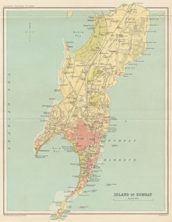
A larger version is available by clicking on the map above.
|
| Creator: |
J.G. Bartholomew |
| Title: |
Burma (Northern Section) |
| Imprint: |
Imperial gazetteer of India. New edition, published under the authority of His Majesty's Secretary of State for India in Council. Oxford: Clarendon Press, 1907-1909.
Volume 9, opposite page
240. |
| Scale: |
1:6,000,000. 1 in. to 94.6 miles. |
| Notes: |
Divisions of Burma: 1. Arakan Division, 2. Pegu Division,
3. Irrawaddy Division, 4. Tenasserim Division, 5. Mimbu Division,
6. Mandalay Division, 7. Sagaing Division, 8. Meiktila Division. |
|
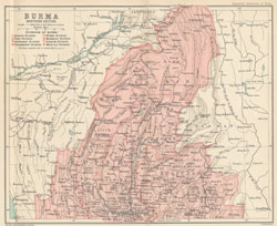
A larger version is available by clicking on the map above.
|
| Creator: |
J.G. Bartholomew |
| Title: |
Burma (Central Section) |
| Imprint: |
Imperial gazetteer of India. New edition, published under the authority of His Majesty's Secretary of State for India in Council. Oxford: Clarendon Press, 1907-1909.
Volume 9, opposite page
240. |
| Scale: |
1:6,000,000. 1 in. to 94.6 miles. |
| Notes: |
Divisions of Burma: 1. Arakan Division, 2. Pegu Division,
3. Irrawaddy Division, 4. Tenasserim Division, 5. Mimbu Division,
6. Mandalay Division, 7. Sagaing Division, 8. Meiktila Division. |
|
A larger version is available by clicking on the map above.
|
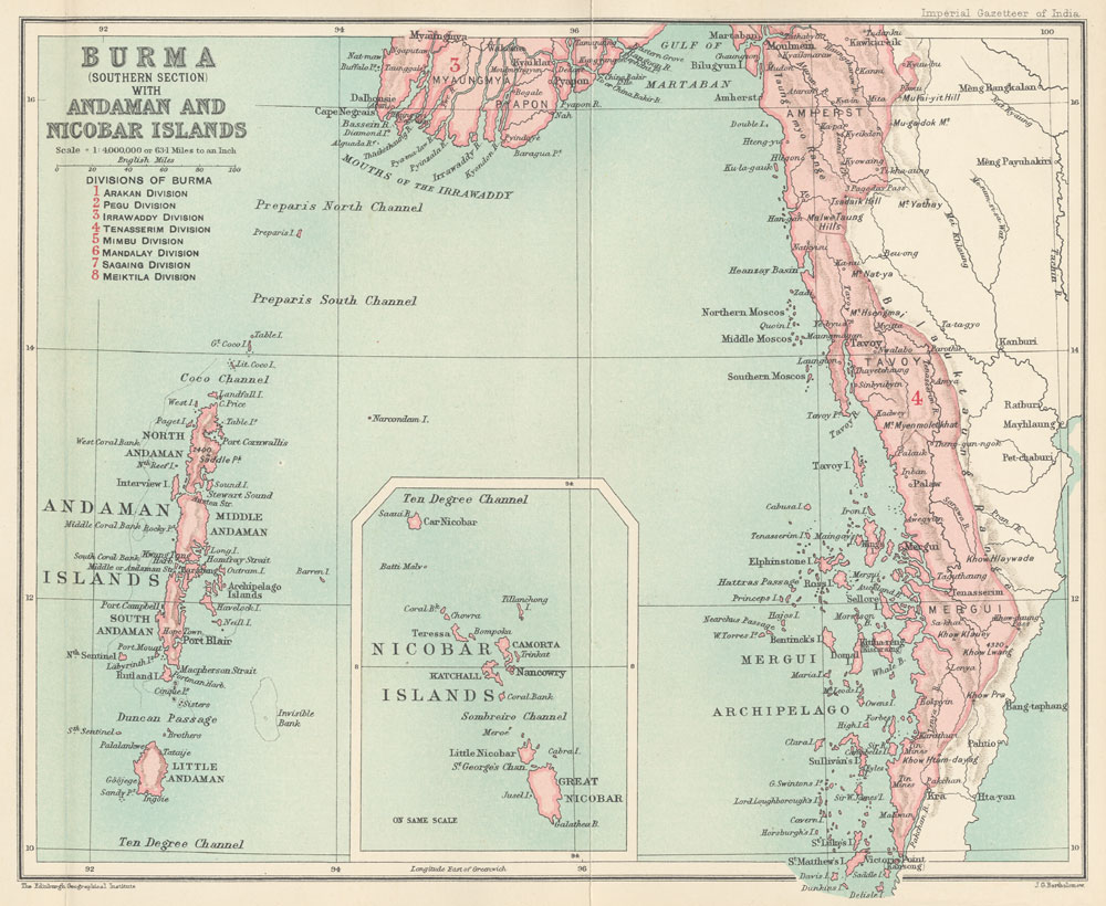
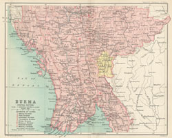
| Creator: |
J.G. Bartholomew |
| Title: |
Burma (Southern Section) with the Andaman and Nicobar Islands |
| Imprint: |
Imperial gazetteer of India. New edition, published under the authority of His Majesty's Secretary of State for India in Council. Oxford: Clarendon Press, 1907-1909.
Volume 9, opposite page
240. |
| Scale: |
1:6,000,000. 1 in. to 94.6 miles. |
| Notes: |
Divisions of Burma: 1. Arakan Division, 2. Pegu Division,
3. Irrawaddy Division, 4. Tenasserim Division, 5. Mimbu Division,
6. Mandalay Division, 7. Sagaing Division, 8. Meiktila Division. |
|
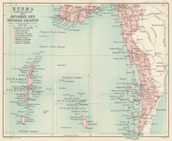
A larger version is available by clicking on the map above.
|
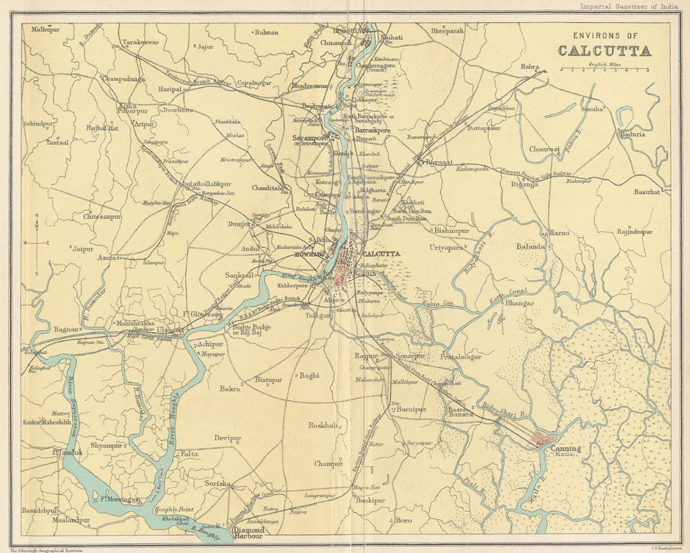
| Creator: |
J.G. Bartholomew |
| Title: |
Environs of Calcutta |
| Imprint: |
Imperial gazetteer of India. New edition, published
under the authority of His Majesty's Secretary of State for India
in Council. Oxford: Clarendon Press, 1907-1909.
Volume 9, opposite page
288. |
| Scale: |
1 in. to 6 miles. |
|
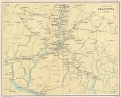
A larger version is available by clicking on the map above.
|
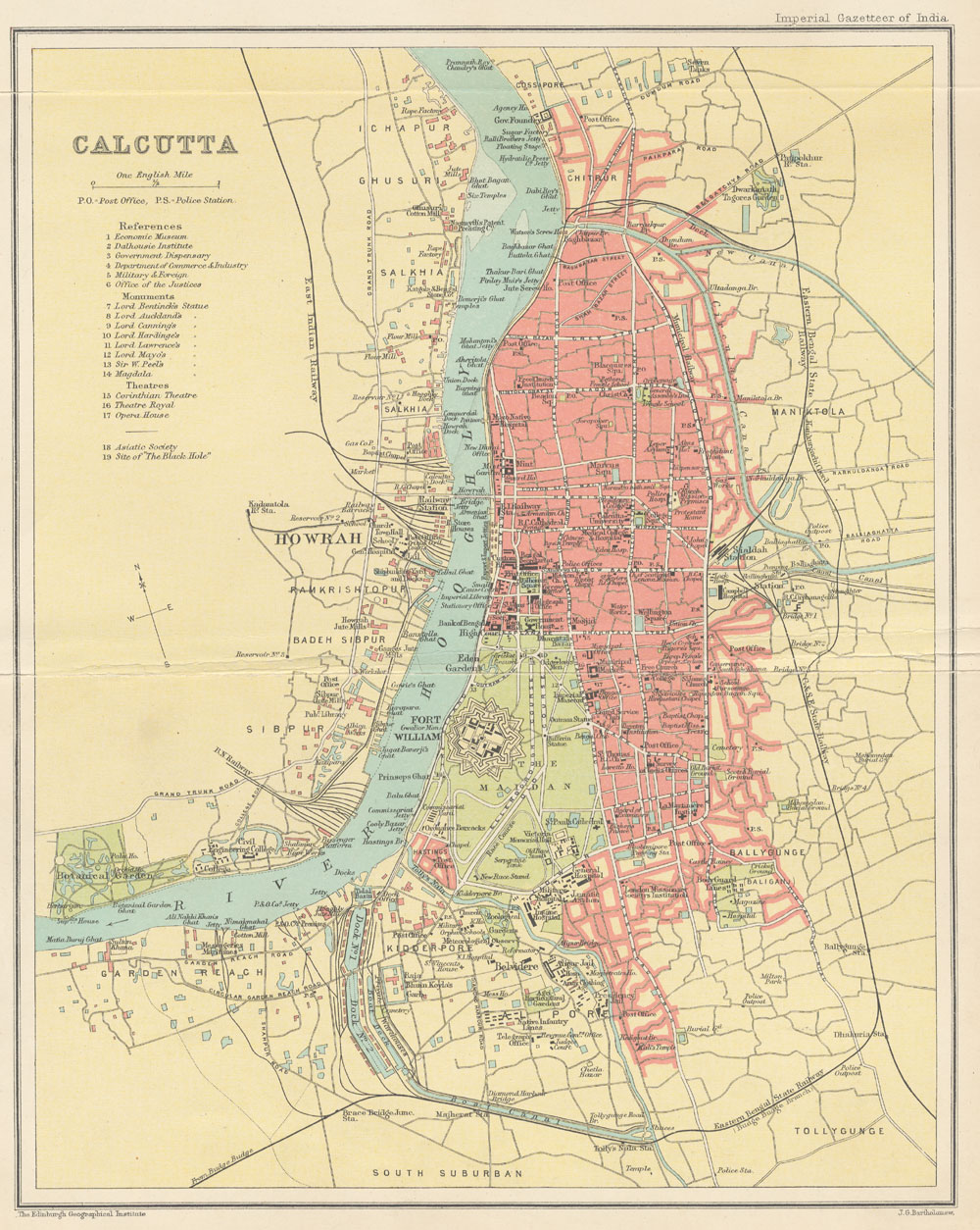
| Creator: |
J.G. Bartholomew |
| Title: |
Calcutta |
| Imprint: |
Imperial gazetteer of India. New edition, published
under the authority of His Majesty's Secretary of State for India
in Council. Oxford: Clarendon Press, 1907-1909.
Volume 9, opposite page
288. |
| Scale: |
1 in. to 1 mile. |
|

A larger version is available by clicking on the map above.
|
| Creator: |
J.G. Bartholomew |
| Title: |
Central India |
| Imprint: |
Imperial gazetteer of India. New edition, published under the authority of His Majesty's Secretary of State for India in Council. Oxford: Clarendon Press, 1907-1909.
Volume 9, opposite page
392. |
| Scale: |
1:6,000,000. 1 in. to 94.6 miles. |
| Notes: |
Divisions of Central India: 1. Gwalior Residency,
2. Bundelkhand Agency, 3. Baghelkhand Agency, 4. Malwa Agency, 5.
Bhopal Agency, 6. Indore Residency, 7. Bhopawar Agency. |
|
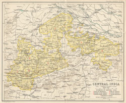
A larger version is available by clicking on the map above.
|
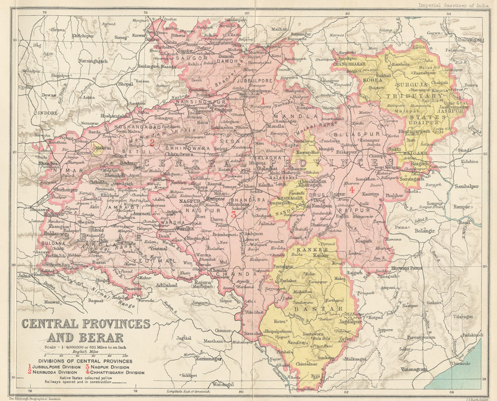
| Creator: |
J.G. Bartholomew |
| Title: |
Central Provinces and Berar |
| Imprint: |
Imperial gazetteer of India. New edition, published under the authority of His Majesty's Secretary of State for India in Council. Oxford: Clarendon Press, 1907-1909.
Volume 10, opposite page
112. |
| Scale: |
1:6,000,000. 1 in. to 94.6 miles. |
| Notes: |
Divisions of Central Provinces: 1. Jubbulpore Division,
2. Nerbudda Division, 3. Nagpur Division, 4. Chhattisgarh Division.
Native States colored yellow. |
|
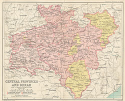
A larger version is available by clicking on the map above.
|
| Creator: |
J.G. Bartholomew |
| Title: |
Eastern Bengal and Assam with Bhutan |
| Imprint: |
Imperial gazetteer of India. New edition, published under the authority of His Majesty's Secretary of State for India in Council. Oxford: Clarendon Press, 1907-1909.
Volume 11, inside back cover. |
| Scale: |
1:6,000,000. 1 in. to 94.6 miles. |
| Notes: |
Divisions of Eastern Bengal and Assam: 1. Dacca Division,
2. Chittagong Division, 3. Rajshahi Division, 4. Assam Valley Division,
5. Surma Valley and Hill Districts Division. |
|
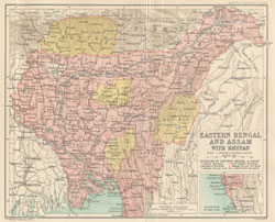
A larger version is available by clicking on the map above.
|
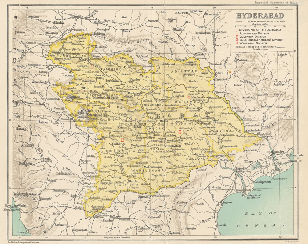
| Creator: |
J.G. Bartholomew |
| Title: |
Hyderabad |
| Imprint: |
Imperial gazetteer of India. New edition, published under the authority of His Majesty's Secretary of State for India in Council. Oxford: Clarendon Press, 1907-1909.
Volume 13, opposite page
304. |
| Scale: |
1:6,000,000. 1 in. to 94.6 miles. |
| Notes: |
Divisions of Hyderabad: 1. Augangabad Division, 2.
Gulbarga Division, 3. Gushanabad (Medak) Division, 4. Warangal Division. |
|
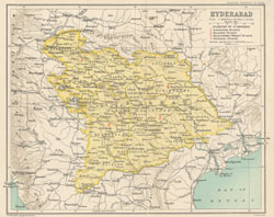
A larger version is available by clicking on the map above.
|
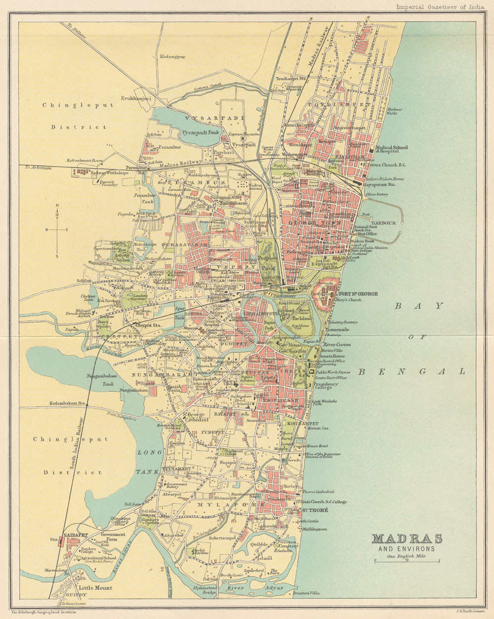
| Creator: |
J.G. Bartholomew |
| Title: |
Madras and environs |
| Imprint: |
Imperial gazetteer of India. New edition, published
under the authority of His Majesty's Secretary of State for India
in Council. Oxford: Clarendon Press, 1907-1909.
Volume 16, opposite page
378. |
| Scale: |
1 in. to 1 mile. |
|
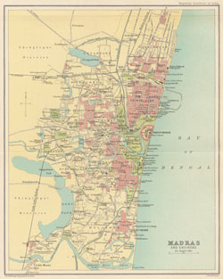
A larger version is available by clicking on the map above.
|
| Creator: |
J.G. Bartholomew |
| Title: |
Madras (Northern Section) |
| Imprint: |
Imperial gazetteer of India. New edition, published
under the authority of His Majesty's Secretary of State for India
in Council. Oxford: Clarendon Press, 1907-1909.
Volume 18, opposite page
250. |
| Scale: |
1:6,000,000. 1 in. to 94.6 miles. |
|
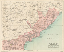
A larger version is available by clicking on the map above.
|
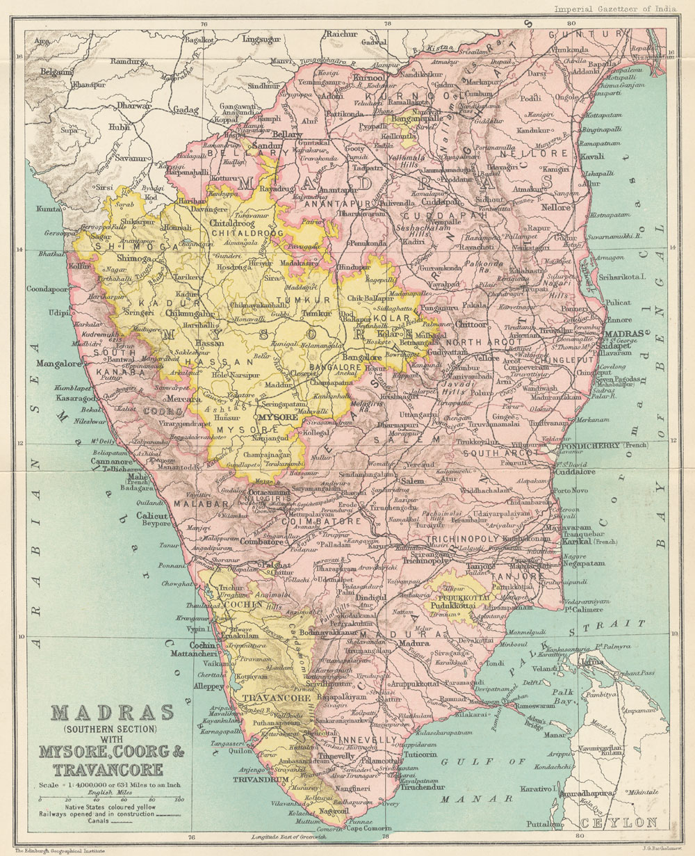
| Creator: |
J.G. Bartholomew |
| Title: |
Madras (Southern section) with Mysore, Coorg,
and Travancore |
| Imprint: |
Imperial gazetteer of India. New edition, published
under the authority of His Majesty's Secretary of State for India
in Council. Oxford: Clarendon Press, 1907-1909.
Volume 18, opposite page
250. |
| Scale: |
1:6,000,000. 1 in. to 94.6 miles. |
|
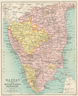
A larger version is available by clicking on the map above.
|
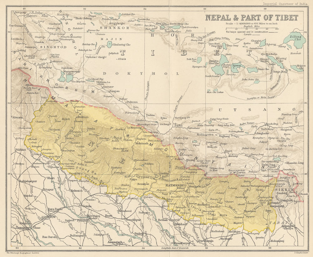
| Creator: |
J.G. Bartholomew |
| Title: |
Nepal and part of Tibet |
| Imprint: |
Imperial gazetteer of India. New edition, published
under the authority of His Majesty's Secretary of State for India
in Council. Oxford: Clarendon Press, 1907-1909.
Volume 19, opposite page
42. |
| Scale: |
1:6,000,000. 1 in. to 94.6 miles. |
|
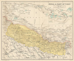
A larger version is available by clicking on the map above.
|
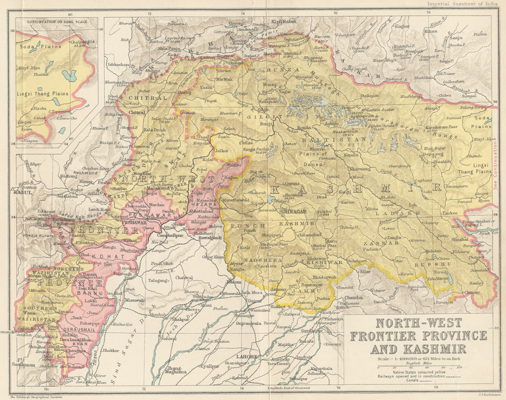
| Creator: |
J.G. Bartholomew |
| Title: |
North-West Frontier Provinence and Kashmir |
| Imprint: |
Imperial gazetteer of India. New edition, published
under the authority of His Majesty's Secretary of State for India
in Council. Oxford: Clarendon Press, 1907-1909.
Volume 19, opposite page
218. |
| Scale: |
1:6,000,000. 1 in. to 94.6 miles. |
|
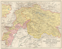
A larger version is available by clicking on the map above.
|
| Creator: |
J.G. Bartholomew |
| Title: |
Punjab |
| Imprint: |
Imperial gazetteer of India. New edition, published under the authority of His Majesty's Secretary of State for India in Council. Oxford: Clarendon Press, 1907-1909.
Volume 20, opposite page
394. |
| Scale: |
1:6,000,000. 1 in. to 94.6 miles. |
| Notes: |
Divisions of the Punjab: 1. Delhi Division, 2. Lahore
Division, 3. Jullundur Division, 4. Rawalpindi Division, 5. Multan
Division. |
|
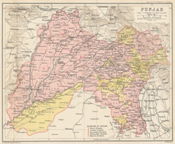
A larger version is available by clicking on the map above.
|
| Creator: |
J.G. Bartholomew |
| Title: |
Rajputan with Amjer-Merwara |
| Imprint: |
Imperial gazetteer of India. New edition, published under the authority of His Majesty's Secretary of State for India in Council. Oxford: Clarendon Press, 1907-1909.
Volume 21, opposite page
154. |
| Scale: |
1:6,000,000. 1 in. to 94.6 miles. |
| Notes: |
Divisions of Rajputana: 1. Western Rajputana States
Residency, 2. Haraoti and Tonk Agency, 3. Mewar Residency, 5. Eastern
Rajputana States Agency, 6. Kotah and Jhalawar Agency. |
|
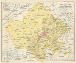
A larger version is available by clicking on the map above.
|
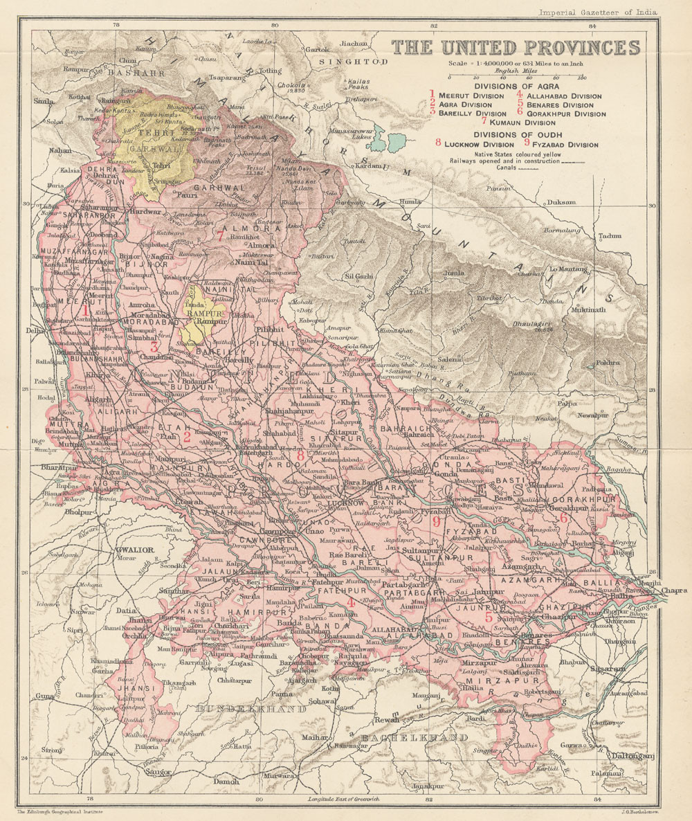
| Creator: |
J.G. Bartholomew |
| Title: |
United Provinces |
| Imprint: |
Imperial gazetteer of India. New edition, published under the authority of His Majesty's Secretary of State for India in Council. Oxford: Clarendon Press, 1907-1909.
Volume 24, opposite page
250. |
| Scale: |
1:6,000,000. 1 in. to 94.6 miles. |
| Notes: |
Divisions of Agra: 1. Meerut Division, 2. Agra Division,
3. Bareilly Division, 4. Allahabad Division, 5. Benares Division,
6. Gorakhpur Division, 7. Kumaun Division. Divisions of Oudh: 8.
Lucknow Division, 9. Fyzabad Division. |
|
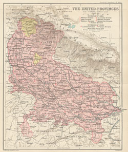
A larger version is available by clicking on the map above.
|